Monday, August 9, 2010

Matheson Lake 31/21 weeks

We LOVE this lake! Not enough to move to Metchosin, but still.

Mark and I chose Matheson Lake for our 31st outing.  It is one of my favourite places on this part of the island; more rugged and longer than the trail around Durrance Lake. It is also all the way over in Metchosin so we don't get over there very often. Matheson Lake has almost 4 km of trails with a couple of cuts into the waters edge. It is picturesque in any season. Since it is a large lake the winds in certain spots can be sharp.

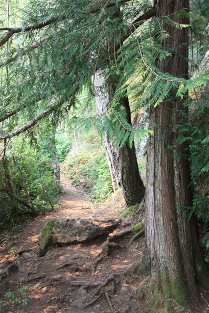
Always amazed that the trees seem to grow right out of the rock here.

Mark wore red so I wouldn't lose him.


On the day that we were there the sky was reflecting the recent Albertan forest fires and so the light had a beautiful rose coloured cast to it. We kept stopping to take photos to illustrate the gorgeous lighting. Im sure we fell well short.
The lighting almost makes the forest look on fire. 
At The Moss Street Market Paint-in of 2008 I was approached at my massage booth by a woman with a request that I visit her friend as a massage patient. When I learned that he lived outside of Metchosin, I was very reluctant to travel that far on a weekly basis and made up my mind that I would charge him a travel stipend. He called and charmed me into becoming his bodyworker. The idea was made more appealing by my resolve to hike Matheson Lake after our weekly sessions.
The pot was also sweetened by showing up and meeting local artist and fellow ex-pat Jimmy Wright. I enjoyed his company and our time together and I was inducted into a small club of people whom Jimmy called 'little buddy'. He gave up his battle with cancer at the end of that summer and Im grateful that I was able to spend time with him and ease some of his discomforts. Mark and I remembered Jimmy on our hike. One of my scheduled massages that year fell on Mark's birthday so I brought him along to Metchosin and we hiked the lake as part of his birthday celebrations.


We bushwhacked our way atop this grass covered rock in order to avoid the two young families that were right behind us on trail. Now it will always be our own special outlook.

Buddha on the rocky out cropping.

A painter would have had better luck capturing this amazing light.

Velcro ball dog. Im still not sure how Mark was able to clean his coat. Yes, that is a pinecone on his head.
I am not a red head but this photo illustrates the whacky lighting for the day.
 All in all, we were in the park for 2 hours. We took pictures and rested, we had a picnic and watched the energy of the wind make designs on the surface of the water. I do not exaggerate when I tell you that I love this park. Make a day of it and go explore for yourself. Just getting out into the Metchosin countryside is a wonderful treat. If you make your plans to go on a sunday in the summer you could also visit the Metchosin Farmers market for some fresh veggies and interesting hand crafted delights. 

Zero Five Juliet
This is a copy of one of Jimmy's prints that hangs in our kitchen.
RIP Jimmy 1937-2008


spacer


Monday, August 2, 2010

John Dean Park; Pickles Bluff 30/22 weeks

IMG_3336
The view from Pickle's Bluff is incomparable.

Here is the thing about summits and peaks; many times they are not the best part of the hike. Indeed, we mostly get to the top of a hill, mountain or monadnock in order to say that we have been there. I can think of a few hikes where the summit was anti-climactic. The summit at Mt. Work is difficult to discern. You could probably start hiking down the other side without even knowing you had just crested the summit. Old Baldy's summit was a barren jumble of sun-fed rocks and we paused only long enough for a couple of pictures. At both of these locations there are look out points before the summit that are much more hike-worthy.
The hike up to the summit of John Dean park and BACK DOWN a secondary trail is the most sterling example of this. The very apex of John Dean park is only note worthy because it is a summit. Sure, there is a look out platform and sure, when you look across the trees you can see a chain of islands and beautiful coast. But you are also sharing the summit with a communication tower and a weather station. It was the destination of our 5th hike and we were all glad to get there. We pretty much ignored the sign for Pickles Bluff; I was curious but the troupe was fatigued and I wasn't sure about the secondary trail. Im glad that we did not explore it that day.
Mark and I made it a destination hike for this outing. From the parking lot we took Thunderbird trail up into the woods. It is a fairly short jaunt through the trees and ends at the joining of the access roads.  You will want to turn left out of the woods but stay on the larger road to the right. This hike will take you up to the communications tower summit and the sign for Pickles Bluff is across the road.
This is a relatively short hike through woodland trail and boardwalks. There are a few sets of sturdy stairs. The entire time I was thinking this cant be right. How can a person get to the summit and then access a lookout by hiking DOWN? It is a steady descent. Pickles Bluff is the bald outcropping of rock seen from East Saanich road about 3/4 of the way up Mt Newton.

IMG_3331
Mt.Baker

IMG_3341

IMG_3338
Looking south toward Victoria. 

IMG_3344
This is the giant at the head of Thunderbird Trail.

In all 30 weeks of hiking I have never seen a more beautiful view of this island. This viewpoint has everything. It is a panorama from the Gulf Islands to Victoria.  It is a short hike leaving more time for relaxing and soaking up the view. It is a vigorous hike so we got the heart rate up and its a pretty steep trip back which is good for the hamstrings. We were on Mt. Newton less than an hour but really felt the workout. One draw back; it is a natural outcropping of rock and there is no platform or guard rail. So exercise caution with children or exuberant fellow hikers. A good rule of thumb is to just enjoy the view from well away from the edge. Next time I will bring a map of the Peninsula so that I can be sure of the geography that I am seeing.  We were there at noon and were able to see Cordova Spit due to the low tide.
Another delight about this hike were the dozens of dragonflies. They cruised the rocks in a steady stream. There were so many, I was surprised there were no birds preying on them.
I have been so taken with Pickles Bluff, it will now be a destination hike for visiting friends and family. If you decide to go on one short hike this year based on anything at all that Ive written about on 52weeks, I whole heartedly recommend Pickles Bluff. You will not be sorry that you took the time and effort. I cant wait to visit in the fall to see the display of changing colors.

IMG_3347
Pickle's Bluff from East Saanich road.

Sunday, August 1, 2010

Goldstream trestle bridge trail 29/23 weeks


Standing at the base of the falls in Niagra Canyon.

On Sunday Mark and I hiked at Goldstream Provincial Park. We plan to hike Mt Finlayson eventually but for today we chose the trail that winds around Niagra Canyon and up to the C&N rail trestle bridge.We told our son we were heading to Goldstream and wanted a hiking goal. He asked if we would prefer the 'Wall of Death' or the 'River valley of Death'. Frankly, we are getting too old to hike anything that has the word death attached to it but it was a nice ego boost to think that our son thought we were capable of it.
Goldstream is a BC Park and, as such, qualifies for next years blog celebrating the 100th birthday of the formation of BC parks. We will tick that one off the list by camping there, but that is another blog. 2011.
It turns out that Mark and I have hiked this trail before. Its a testiment to our hiking commitment and our subsequent fitness that I remember the trail being longer, steeper and hotter.
However, I didnt remember making it to the trestle bridge. As you come up over a steep portion, look up to see the trestle standing tall and strong against the sky with its bridgework blackened by age. It can really be breathtaking. And I wish I could show you. However, blogspot.com will only allow me to load these two measily photos that do NOTHING to show the beauty of this park. Or the height of Niagra Canyon.
Niagra Canyon base looking across Highway One at Mt. Finlayson.
At the trestle looking back over the Highway it is easy to see that only the very tip of Mt. Finlayson is left. Of course if you have ever hiked Finlayson then you know the tip is the hardest part; where you cling to bare rock on narrow trails that wind over the controversial golf course.
Apparently the C&N train only runs in the morning and evening so you are alright to walk out onto the trestle bridge. It is a long span over Niagra Canyon and has no railings; just platforms to hunker down into should you be unfortunate enough to have the train roar past while you are up there.
I love trestle bridges. They are a fine example of the engineering feats of a time gone by. When men put their heads together to figure out how to get goods and people across a span. They are fading from our landscapes as they weather and rot and the cost of replacing them becomes higher and higher.
I will try to post some pictures later and will alert to their presence on more recent blogs.

Friday, July 30, 2010

still hiking....

Hello out there to those who are following the hiking adventure. Blogspot is refusing to allow the loading of any photos. Since I think this blog is nothing without the photos of this gorgeous island, I will be working on fixing this technical difficulty as soon as possible. It could be that I may have to switch blog hosts. We are still hiking every week and taking our photos in the hope that we will be up and running again soon. In the meantime,  check out the blogs of our two beautiful and talented daughters.
http://spherestamper.blogspot.com
http://catasaurusrex.tumblr.com

Monday, July 12, 2010

Strawberry 'hike" 28/24 weeks

We are pretty proud of our bounty.

Dan's professional signage warning us to stay out of the raspberries.
This is the week that we decided this blog should be less about hikes and more about just getting out and enjoying the area. Our original intention with the blog was to do this each weekend without fail. So this Sunday we thought we would park our car and 'hike' in to the fields to pick our yearly supply of strawberries. Little did we realize that it was actually a pretty long and hot hike to the berry fields.


We pick at Dan's Country Market because they are pretty consistent about making their fields available to pickers. They are also pest managed, if not organic. The trick is to get yourself far enough into the fields to find the best, fattest, juiciest and reddest berries. This field is at the foot of Bear Hill, from weeks number 2 and 22. I love the area so much that I kept pausing to look over at my beloved Hill, mainly because I simply can't believe we live in such a beautiful place.
This outing made me especially miss our oldest daughter who is in France this summer. This was the U Pick field we came to when we first immigrated to Canada and Hillary was always with us for a strawberry picking adventure. Now that we have introduced Hannah to our summer Mecca we anticipate her joining us whenever we go.
Bear Hill doesn't look very big from here...
Hannah showing off an enormous berry that she will probably eat before we get back for the weighing. That is the beauty of U Pick.
Our collective effort yielded approximately 40 pounds of berries.

Tuesday, July 6, 2010

Durrance Lake night hike 27/25 weeks

The only picture of the two of us that came out...Mark thinks it perfectly sums up our adventure.

We had such a busy weekend planned that our hiking time has been seriously compromised for our 27th outing. Mark and I hosted a massage booth at the 2010 Pridefest and we knew that would have us gone all day. I was invited by Mark on a date night to watch the third Twilight movie; Eclipse on Saturday night and I wasn't going to let hiking interfere with that. We decided to try something different and go on a night hike.
We chose the path around Durrance Lake because it is close to our home and a short hike. If you remember the blog from week 9, the Durrance Lake loop is half woods and half lake path. We began at the trail into the woods as it was getting darker fast and we wanted the most level portion to be the part in complete darkness.
Let me start by saying that I have a very vivid imagination. I have read all of Stephen King's novels and I have seen many, many scary movies. I can not say that I recommend a night in the dark woods after seeing a vampire/werewolf film. I had a flashlight but in a lot of ways that just made it worse. I kept asking myself what I would do if a person, monster or thing loomed into the light of my lamp. This is not a good place for the mind to go in the dark. I kept fighting down the urge to completely run into the opposite direction.
This is the view from the dam on the south side of the lake.
In fact, the only two things that kept me from bolting was the dark terrain and my fear of falling coupled with the amount of teasing and laughter I would have to endure from Mark. I simply reminded myself that this was my idea and swallowed the ball of fear that kept creeping into my throat whenever I came upon a darker curve.
The path seemed so different from our last visit because we were moving in the opposite direction so I was always questioning whether we were terribly lost in the dark.
At one point we heard a huge crash in the brush. Despite the fact that our dog was not concerned in the least, I made Mark walk in front of me. At least he would block the imminent appearance of a woodland monster from my view.
Would I recommend a night hike? You bet ya. It really got my blood going and pushed me straight out of my comfort zone which is something I really need these days. If you decide to try one choose a path that is somewhat level to avoid injury. Also choose a path that you know fairly well. In the dark it will morph into a completely different place but hopefully you will be comforted by some familiar terrain.
Sorry about the lack of decent photos. This night hike thing is new to me. Actually I cant wait to do this again. Perhaps I'll schedule one after I see the new Harry Potter film.

Eerie...


Thursday, July 1, 2010

Gorge Waterway 26/26 weeks

Posing at the Admirals St. end of the waterway.

This was our 6th month mark on the 52week commitment blog. Our record stands at 26 weeks 0 blisters. So it was a happy little group who assembled at the Esquimalt Gorge park on Sunday. This park is known as the Kinsmen Gorge park and it lays just at the Gorge bridge on Tillicum Rd. We wanted to have a picnic celebration at the end of our walk and chose a park with picnic tables. We also decided to try a park with a relatively level surface. Deciding on the gorge waterway made this weeks outing more of a leg stretcher so we donned our runners and headed out.
Our group consisted of Mark and I, Hannah and friends Jon and Aaron. The gorge is a popular walkway with a variety of attractions. The level walkway makes it the perfect choice for people with limited mobilities and families with young children. There are plenty of park benches and low rock walls should you need to stop for rests.
We started our walk on the Esquimalt side of the gorge. This park boasts of benches, picnic tables and restrooms. There is also a beautiful slice of beach and extensive playgounds. Which reminds me that I had planned to share this playground blog because I think it is a clever resource for families with young children.

Jon and Mark heading for the Tillicum Road bridge at the beginning of the walk.

Looking out over the tranquil water.

The brand new sculpture honoring Camossung and the spiritual place at the meeting of the waters.
Looking for the sacred stone on the south side of the bridge, Hannah checked her iPhone compass application. It wasn't lost on us that our only compass consultation of the year was in one of the most civilized locations...


The walkway stretches from Tillicum Road to Admirals/Craigflower bridge. Along the way are well loved and impeccably tended garden spaces. This site is a popular one in Saanich for festivals. Canada Day Picnic on the Gorge is my favorite place in the city to celebrate Canada Day. Surrounded by small neighborhoods and close to the city, the Gorge attracts families and retirees alike. So the festival atmosphere is always relaxed and calm. If you havent experienced it yet Saanich invites 45 area artists to come together for Gorge on Art. It can be windy along the waterway and this event attracts quite a crowd so be prepared to walk slowly.
I will plant one of these delights at my house just as soon as someone tells me what it is. It looks as if brilliant dandelions are bursting from a little green tree.

We found a small cut from the bridge onto the Gorge road side. This popped out behind the rowing club.

Another view of the glass-like surface of the gorge.
We walked from the Esquimalt Gorge parking lot to Admirals Road and back again. We were on the waterway for approximately 90 minutes. There is parking along Gorge Road in certain places as well as a lot at the end at Admirals Road. The gorge is also accessible by transit with stops the length of the waterway.
So, heres to 26 weeks of outings in 2010. I have every reason to believe that the next 26 weeks will be just as fun and adventurous as the last. Cheers.

Ok. Enough messing around, picnic lunch awaits.

Next week: Sunday is PrideFest and Mark and I are hosting a massage booth at Fisherman's Wharf.  We will probably snatch a quick hike on Sat. afternoon.